Trail Walking Guils de Cerdanya - station ski de fond du Guils - la llosa - refuge de les cases - Photo

station ski de fond du Guils - la llosa - refuge de les cases

 mikaou.t
mikaou.t

User

© OpenStreetMap contributors
Length
Length
6.3 km
Max alt
Max alt
1975 m
Uphill gradient
Uphill gradient
168 m
Km-Effort
Km-Effort  
8.5 km
Min alt
Min alt
1818 m
Downhill gradient
Downhill gradient
167 m
Boucle
Boucle
Yes
Creation date :
2017-08-17 00:00:00.0
Updated on :
2017-08-17 00:00:00.0

(0 Reviews)

Walking
Walking
1h53
Difficulty : Medium

Scan this QR Code to open this trail in the SityTrail application

FREE GPS app for hiking

Logo SityTrail SityTrail

IGN / Geographical institutes

Download SityTrail from the App Store Download SityTrail from Google Play

Logo SityTrail SityTrail World

The world is yours!

Download SityTrail from the App Store Download SityTrail from Google Play Download SityTrail on Huawei AppGallery

About

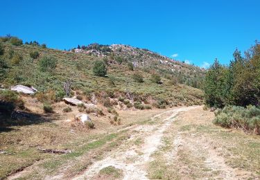
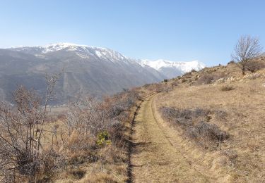
Trail Walking of 6.3 km to be discovered at Catalonia, Girona, Guils de Cerdanya. This trail is proposed by mikaou.t.

Description

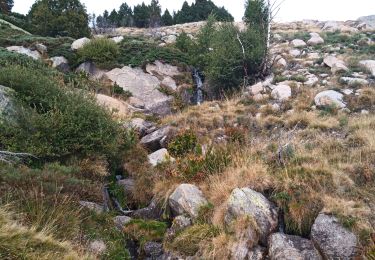
Belle Randonnée avec vues superbes sur la Cerdagne Française. Source fraîche juste sous le refuge.

Elevation profile

Positioning

Country:
Spain
Region :
Catalonia
Department/Province :
Girona
Municipality :
Guils de Cerdanya
Location:
Unknown
Start:(UTM)
404952 ; 4701315 (31T) N.

Trails nearby

Trail Walking Enveitg - Bena - Photo
Walking
sereton

Walking

Medium
Enveitg, Occitania, Pyrénées-Orientales, France
11.9 km | 21 km-effort
3h 32min
No
Trail Walking Latour-de-Carol - La Tour de Carol - Photo
Walking
sereton

Walking

Easy
Latour-de-Carol, Occitania, Pyrénées-Orientales, France
15.1 km | 22 km-effort
4h 10min
Yes
Trail Walking Latour-de-Carol - Latour-de-Carol, Les Fontanelles - Photo
Walking
rene091957

Walking

Difficult
Latour-de-Carol, Occitania, Pyrénées-Orientales, France
9.6 km | 14.5 km-effort
3h 17min
Yes
Trail Walking Latour-de-Carol - Prat Redon - Chemin du Llavinet - Photo
Walking
rene091957

Walking

Very difficult
Latour-de-Carol, Occitania, Pyrénées-Orientales, France
16.4 km | 25 km-effort
5h 42min
Yes
Trail Walking Enveitg - Vers Bena, centre de vacanced - Photo
Walking
Jacpro

Walking

Medium
Enveitg, Occitania, Pyrénées-Orientales, France
5.8 km | 8.3 km-effort
2h 9min
Yes
Trail Trail Latour-de-Carol - Boucle de Latour-de-Carol - Photo
Trail
toutankhcarton

Trail

Medium
Latour-de-Carol, Occitania, Pyrénées-Orientales, France
8.1 km | 12.2 km-effort
1h 13min
No
Trail On foot Latour-de-Carol - Le Prat Redon  - Photo
On foot
rene091957

On foot

Medium
Latour-de-Carol, Occitania, Pyrénées-Orientales, France
14.5 km | 22 km-effort
Unknown
No
Trail Walking Latour-de-Carol - Saneja - Photo
Walking
JFROBERT

Walking

Very easy
Latour-de-Carol, Occitania, Pyrénées-Orientales, France
9.8 km | 13.5 km-effort
2h 56min
No
Trail Walking Enveitg - enveigt pic puntxo - Photo
Walking
Erius

Walking

Difficult
Enveitg, Occitania, Pyrénées-Orientales, France
17 km | 30 km-effort
7h 34min
Yes


Close
My subscriptions